It Happened There, That Night! (2024)
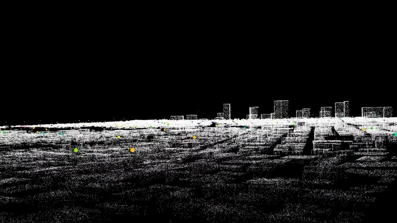
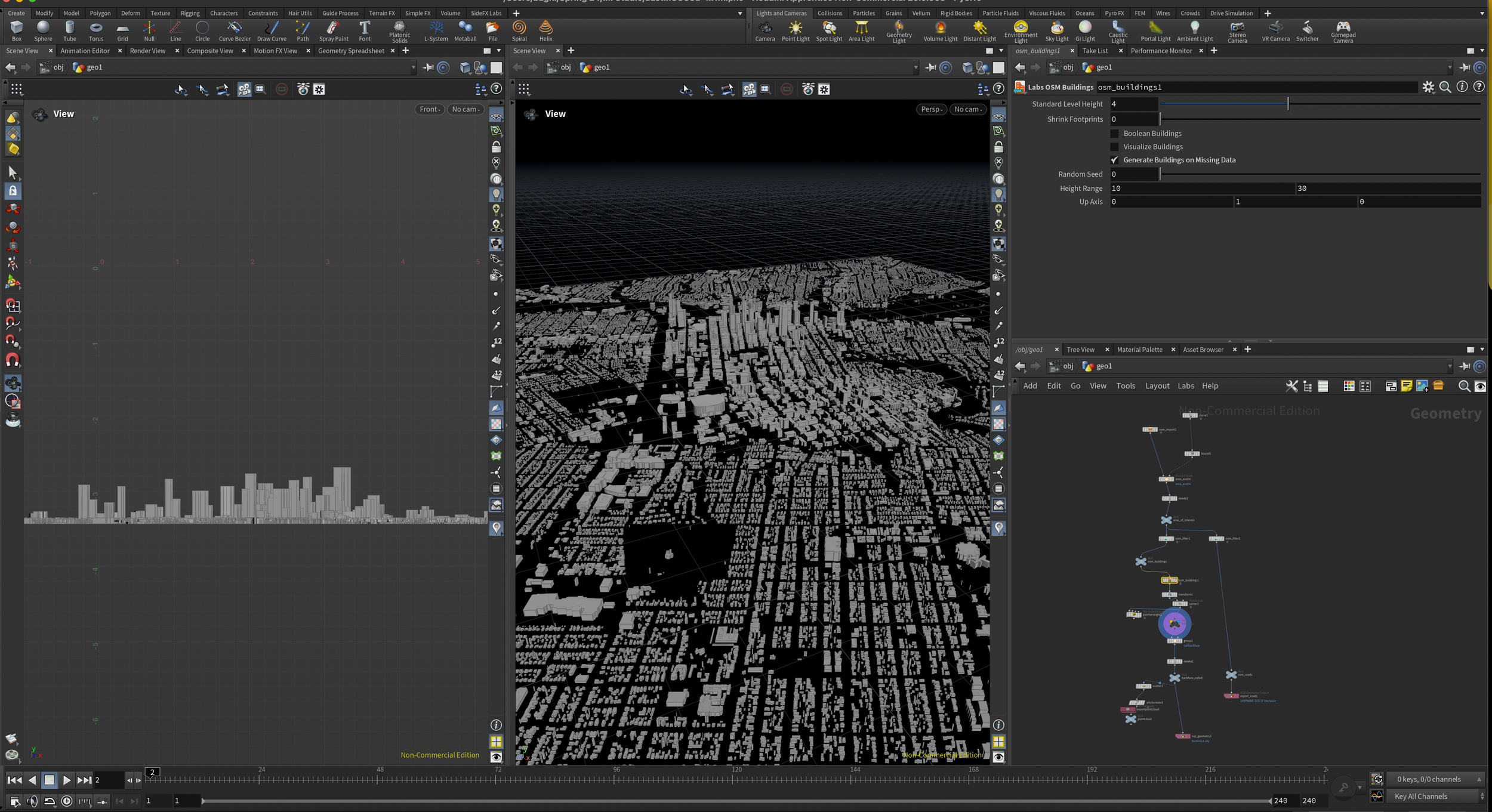
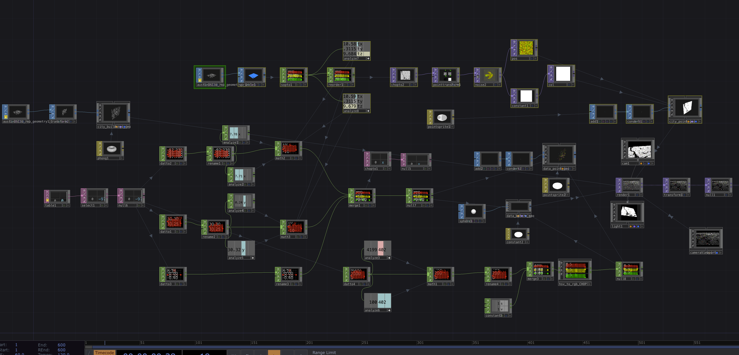
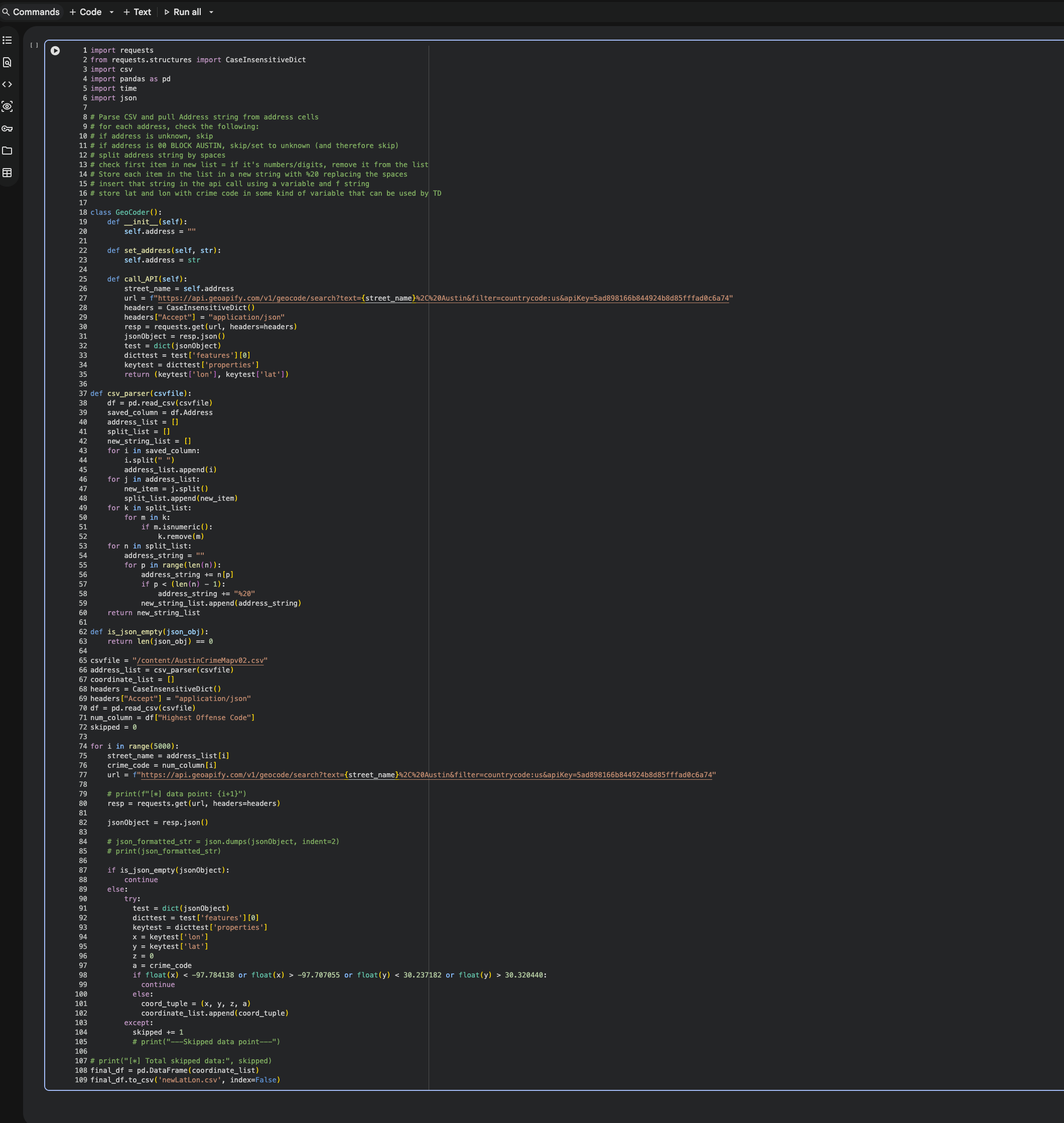
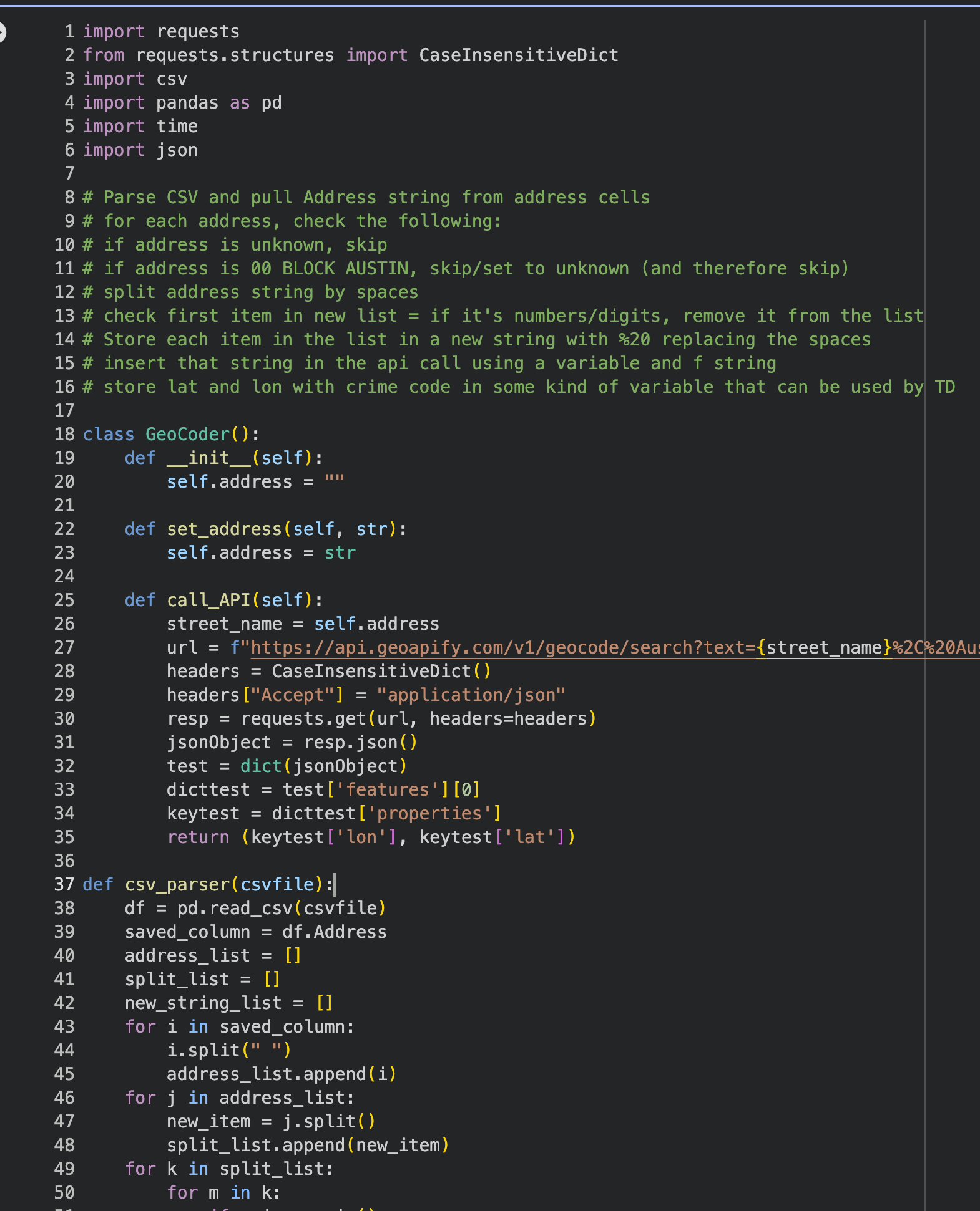
This is an interactive data-driven video installation mapping ten years of crime reports in Austin (2005–2015). Public records from the city website were processed through the GeoApify API to convert street addresses into latitude and longitude coordinates, which were stored in structured CSV files and imported into TouchDesigner as tables. These coordinates function as dynamic points whose attributes (crime type, frequency, time, and severity) are translated into visual properties such as color, scale, and movement. A 3D model of downtown Austin was built from OpenStreetMap (OSM) data in Houdini FX and converted into an OBJ point cloud in Touchdesigner. The crime data is overlaid onto this urban mesh, allowing the audience to navigate a fly-through environment where incidents appear spatially across the city while revealing contextual information.